
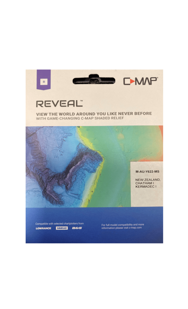
C-MAP Reveal NZ
Rated 5.0 stars
2 Reviews
C-MAP Reveal charts help anglers and divers save time on the water, finding key areas faster with the high-definition views of structure, wrecks and contour changes on the sea floor. The high-detail C-MAP Reveal imagery replaces shaded relief data in selected areas with more accurate depth variations, revealing the best fishing and diving spots. C-MAP Reveal charts include C-MAP HRB Coastal Data, Genesis social map data and satellite imagery that can be overlaid on top of the standard vector charts used for navigation.
The ultimate chart for Coastal exploring - with all the features of DISCOVER and more. Shaded Relief will let you see the seafloor like never before, previously only available in select areas, now available everywhere. Identify structure, reefs and ledges to find the best fishing and diving spots.
Packed with features, including Tides & Currents, Raster Charts, Satellite Overlay and Aerial Photo's and 12 months free updates.
C-MAP Reveal NZ Features:
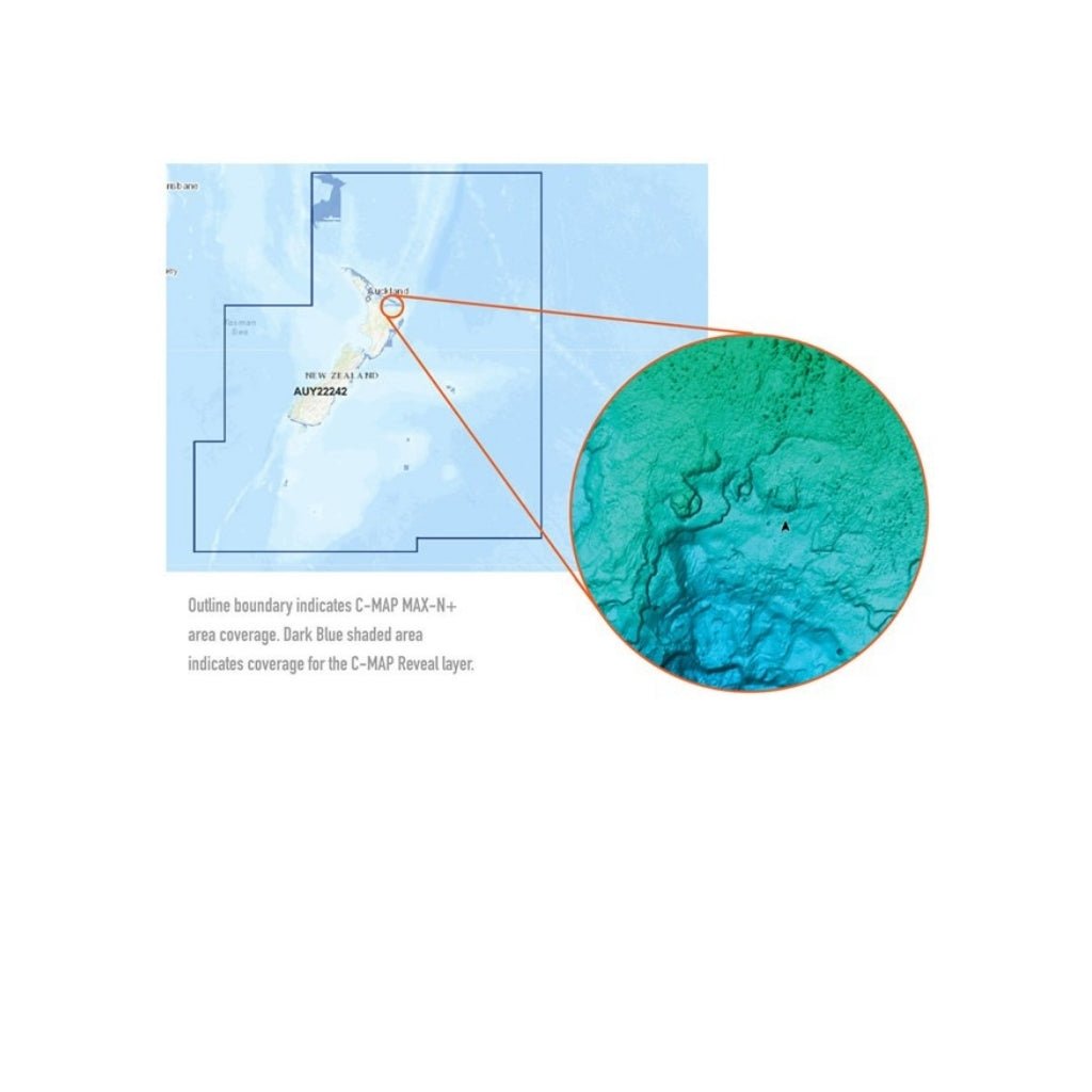
- Bring the world around you to life, with 3D rendered land and underwater elevation - including select areas of Ultra-High Res Bathymetric imagery previously only available in MAX-N+ Reveal - a game-changer for anglers and divers.
- Full Featured Vector charts make navigation easy by giving you accurate, up-to-date vector chart detail derived from official Hydrographic Office information.
- High-Res Bathy helps you identify shallow areas, drop offs, ledges, holes or humps by accurate contour lines down to 1-foot level of detail. Includes the very best of C-MAP HRB data, and Genesis social maps, quality controlled and fully integrated.
- Custom Depth Shading allows you to set a safety depth, maintain a paper-like view or set your own custom shading - see things your way.
- Satellite imagery gives information about the surroundings when you find yourself in an unfamiliar place.
- A collection of thousands of photos of marinas, harbours, inlets and other notable navigational features included to offer an additional level of detail.
- Providing the traditional chart look and feel, coupled with easy access to all objects on the chart.
- Easy Routing helps you automatically plot the shortest, safest route based on detailed chart data and your personalized vessel information. With C-MAP Easy Routing is always subscription free.
- Tides & Currents show projections of water level and direction of tides to help plan your day out, whether cruising, angling or sailing. *only available with Coastal charts
- Docking in an unfamiliar port is no problem, when you have precise layouts of thousands of marinas, including slip spaces, restricted areas, and other valuable navigation information.